
Table of Contents
Digital crop survey is the mobile-app exercise that records which crop is growing on which plot of land, season after season, instead of leaving it to a handwritten village register.
If you farm in India, the person who walks into your field with a phone is now part of how your crop gets counted. Increasingly, that record also decides how your crop is recognised for credit, insurance and procurement.
This guide explains what the survey records, how it works step by step, what the government says it is for, and where it still falls short. Every number comes from a source linked at the end.
What Is a Digital Crop Survey?
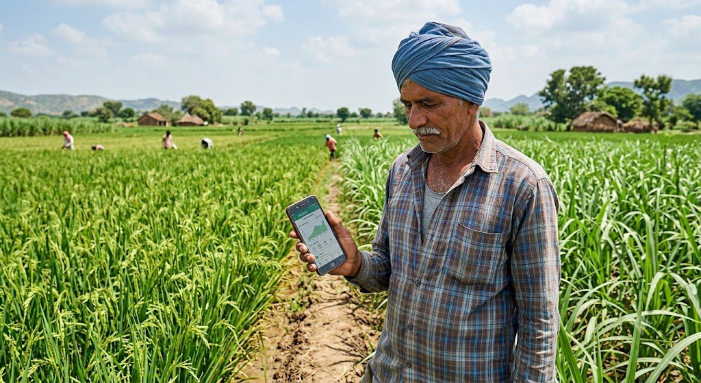
The Ministry of Agriculture describes the Digital Crop Survey (DCS) as a system that collects crop-sown details through a mobile interface, with data captured directly from the field. The goal is accurate crop area information for every agricultural plot, which feeds better production estimates.
In plain words, a digital crop survey replaces guesswork with a geotagged record.
For decades, the crop entry in your land record came from girdawari, a manual inspection by village revenue staff. MicroSave’s analysis lists its weak points: approximations, memory lapses and damaged paperwork.
The survey builds the Crop Sown Registry, one of three foundations of AgriStack alongside the Farmer Registry and geo-referenced village maps. Odisha’s agriculture department says this will show cropping patterns at the farmer and plot level and support personalised service delivery.
7 Essential Facts About the Digital Crop Survey
1. It records your actual crop, plot by plot. Each surveyed plot gets a record of farmer ID, farm ID, village code, year, season, crop, sown area, sowing date and geotags, according to MicroSave.
2. The scale is already national. Government figures reported in August 2026 say the survey covered 648 districts and over 31.3 crore plots in Rabi 2025-26. A year earlier, it covered 461 districts and 23.90 crore plots in Rabi 2024-25.
3. It is seasonal and time-bound. MicroSave says the exercise is usually completed within 45 days. For Kharif 2026, Gujarat ran it from August 15 to September 30 across 95 lakh plots. Bihar began on August 13, aiming to finish 2.62 crore plots by September 30.
4. The app checks itself. Per MicroSave, the app uses geofencing and AI-based image processing, supervisors review samples, and inspection officers check at least 20% of villages in each taluka every season.
5. It sits beside your Farmer ID. More than 10.31 crore Farmer IDs had been created by 3 August 2026. The survey pulls farmer and land details from that registry and the village maps.
6. It is meant to power services. The ministry says the registry is being integrated with agricultural credit, crop insurance, weather advisories and MSP-based procurement. “Being integrated” is not “guaranteed for you today.”
7. Some states let farmers survey their own plots. In Gujarat, farmers registered in the Farmer Registry can do the survey themselves through the app. Older state apps such as MP Kisan, e-Pik Pahani in Maharashtra and Bele Darshak in Karnataka also exist.
How the Digital Crop Survey Works on the Ground
Before the Survey Starts
Village maps and farmland plot details are loaded into the system before each season, as MicroSave describes. That means the surveyor sees your plot boundary on screen before reaching the field.
During the Digital Crop Survey
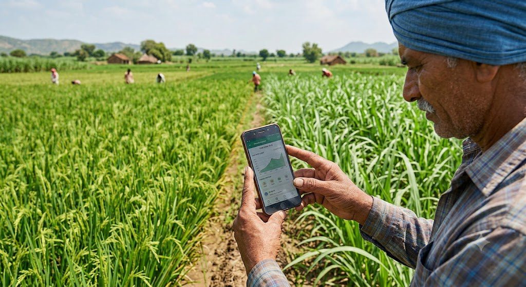
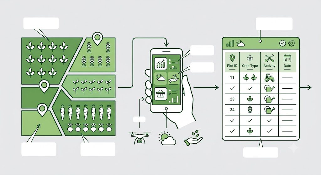
The surveyor, or you in a self-survey state, opens your plot in the app, records the crop and sown area, and uploads geotagged photos. The photo must match the plot’s location, which is what makes the entry harder to fake than a register line.
After the Survey
Supervisors review sample entries and inspection officers audit villages. Once cleared, the data updates the registry for that season. MicroSave adds that the app can give farmers a digitally verified crop-sown certificate, usable as proof for credit and insurance.
What Gets Recorded for Every Plot
| Field recorded | What it means for you |
|---|---|
| Farmer ID and farm ID | Links the crop to you and to a specific plot |
| Village code | Places your plot in the right village record |
| Year and season | Separates Kharif from Rabi entries |
| Crop and variety | The crop actually sown, not last year’s habit |
| Sown area | How much of the plot carries that crop |
| Sowing date | Useful later for insurance and advisories |
| Geotag and photo | Proof the crop was standing at that location |
Each field matters. A wrong crop or wrong plot number travels with your record into every scheme that reads it.
Digital Crop Survey Rollout: Key Numbers
The survey moved from pilot to near-national scale in three years. The table below pulls the reported figures together.
| Period | Reported coverage |
|---|---|
| Kharif 2023 | Pilot in 12 states |
| Kharif 2024 | 436 districts |
| Rabi 2024-25 | 461 districts, 23.90 crore plots |
| Rabi 2025-26 | 648 districts, 31.3 crore plots |
| Kharif 2026 | Gujarat 95 lakh plots and Bihar 2.62 crore plots targeted |
Plots surveyed rose by about 31% between the last two rabi seasons. The figures come from different reports and dates, so treat the comparison as indicative.
Why does the government want this data? MicroSave says plot-level crop data helps estimate market supply and guides decisions on exports, imports and foodgrain allocation for uses such as ethanol. The ministry also says a separate Digital General Crop Estimation System supports crop-yield data for production estimates.
Kharif 2026 Snapshot: Gujarat and Bihar
Two state campaigns show how the process runs on the ground.
Gujarat ran a 45-day digital crop survey from August 15 to September 30, covering 18,197 villages and over 95 lakh plots. Surveyors uploaded geotagged photos through the app, and the Directorate of Agriculture asked farmers to finish all their survey numbers by September 30, either through the village surveyor or on their own.
Bihar began its Kharif 2026 survey on August 13 across all 38 districts, with a target of 2.62 crore plots by September 30.
Both windows have now closed. Rabi dates are notified state by state, so watch your agriculture department’s announcements rather than waiting for the surveyor to find you.
Survey vs. Traditional Girdawari
| Factor | Girdawari | Digital survey (DCS) |
|---|---|---|
| Who collects | Village revenue staff | Surveyors or farmers via app |
| Tool | Paper registers | GPS-enabled mobile app |
| Location proof | Handwritten plot number | Geotagged photos and geofencing |
| Cross-checks | Limited | Supervisor samples and 20% village audits |
| Crop names | Vary by district | Standard crop ID |
Girdawari still matters for administrative land records. The DCS adds a standardised layer on top, and in states like Madhya Pradesh, Maharashtra and Karnataka, older apps must be merged with it.
What It Means for Loans, Insurance and MSP
Here is the practical promise. If your sown crop is recorded accurately, banks, insurers and procurement agencies can verify it without chasing paperwork.
MicroSave’s analysis suggests the verified certificate can also help farmers sell harvest at competitive procurement rates. If you grow rabi crops, our guide to the names of rabi crops and their MSP shows which crops carry support prices.
Now the honest part. No source we reviewed says a bank or insurer will reject you over a bad entry. But if the record says wheat and you sowed mustard, any scheme that reads the record can disagree with your claim. That is a reasonable risk, not a documented rule, and it is why checking your entry matters.
Real Limitations and Open Questions
No credible source calls this a finished system.
- Maps are uneven. MicroSave notes some states have plot-level geo-referencing while others map only at village level, which can put data on the wrong plot.
- Owner and cultivator can differ. Land may sit in a family member’s name while a legal heir farms it. The survey records the plot, not the person.
- Crop naming is messy. Many varieties and hybrids make accurate entry hard without training.
- Tenants depend on state policy. The Farmer Registry can onboard tenant and lessee farmers, but each state decides whether to include them.
- Coverage is not accuracy. The 31.3 crore figure counts plots surveyed, not entries verified. In the sources we reviewed, we found no independent public accuracy audit.
These gaps connect to a wider theme on this site: data only helps when it is correct, as we explained in decision-grade intelligence in agriculture.
Your Data and Privacy
The PIB release says AgriStack follows the Digital Personal Data Protection Act, 2023, collects farmer data only with consent, and shares it with authorised entities for a specific purpose. States keep control of their own data.
Farmers without smartphones can register through Farmer Producer Organisations, Krishi Sakhis and Common Service Centres, per the same release.
As a common-sense precaution, never share an OTP with anyone who visits claiming to be a surveyor. Ask for identification and confirm with your village-level officer.
How to Prepare for the Next Digital Crop Survey
- Check your Farmer ID. Registration is a separate step from the survey. Use a CSC, FPO or Krishi Sakhi if you lack a phone.
- Match plot numbers. Compare your khasra or survey number with your land record and fix mismatches early.
- Note your sowing date and variety. Keep seed bills or bag tags as backup.
- Watch for your village’s schedule. The window is short, so ask your gram panchayat or agriculture office for dates.
- Be present when the surveyor visits. You know what is actually growing, and where.
- Review the entry afterwards. Ask the block office how to request a correction in your state.
- Keep screenshots or receipts. A simple record helps if questions come up later.
Farmers who also track soil and weather data will find the same logic in our guide to AI crop yield prediction, where crop records feed forecasting.
Common Mistakes Farmers Make
- Waiting until the last week. A window of about 45 days leaves little slack.
- Letting “same crop as last year” be entered. The survey is only useful when it reflects what you sowed this season.
- Ignoring land-record mismatches. The app reads revenue records, so errors there become errors here.
- Assuming a Farmer ID means the survey is done. They are separate registries.
- Sharing OTPs carelessly. Verify the person before sharing any personal detail.
The same discipline applies to any farm data tool, including those we cover in digital twins in agriculture.
How We Researched This Guide
We reviewed a PIB release, MicroSave’s analysis of the Crop Sown Registry, Odisha’s agriculture department page, and Kharif 2026 reports from Gujarat and Bihar. We left out surveyor pay and app login steps because they vary by state and we could not verify them. For other technology stories, browse our Agritech category.
FAQs About Digital Crop Survey
1. What is a digital crop survey?
It is a mobile-app exercise that records which crop is sown on each agricultural plot every season, using geotagged photos and village maps instead of handwritten registers.
2. Who conducts the survey in my village?
The survey is generally conducted by state-appointed surveyors, supervisors and inspection officers. In some states, such as Gujarat, eligible farmers registered in the Farmer Registry can also survey their own plots using the designated app.
3. Is it compulsory for farmers?
The Digital Crop Survey is a government initiative, but whether participation is compulsory and what happens if a plot is missed can depend on state rules. Farmers should contact their local agriculture or revenue office for the applicable requirements.
4. How long does the survey window last?
The digital crop survey usually takes around 45 days, according to MicroSave. However, the schedule varies by state and season. Farmers should check their state agriculture department’s announcements for the latest survey dates.
5. Can I do my own digital crop survey?
Yes, in Gujarat, eligible farmers registered in the Farmer Registry can conduct their own digital crop survey using the designated app. In other states, availability and procedures vary, so check with your state agriculture department for the latest rules.
6. Do I need a Farmer ID first?
A Farmer ID is required for certain services, including Gujarat’s self-survey option. Since requirements may vary by state, check with your local agriculture department to confirm whether you need a Farmer ID before the survey.
7. What data does the survey collect?
The survey records details such as Farmer ID, farm ID, village code, year, season, crop type, sown area, sowing date and geotagged photographs. These details help identify which crop is growing on a particular agricultural plot.
8. Is my data safe?
AgriStack follows government-stated data protection measures, including consent-based sharing and access controls. However, complete safety cannot be guaranteed. Farmers should use official services and never share OTPs with unverified individuals.
9. How does it help with insurance and loans?
The Digital Crop Survey can help banks and insurers verify crop details more easily. Verified crop records may support loan applications and crop insurance claims, but approval or payouts depend on the relevant bank, insurer, scheme rules and state procedures.
10. How does the Digital Crop Survey help with crop insurance?
Digital crop records can support crop verification and the integration of agricultural services. However, the effect on a particular insurance policy or claim depends on the scheme, insurer, applicable rules and other required evidence. A survey entry alone does not guarantee a payout.
Final Thought
The digital crop survey is a sensible fix for a real problem: crop records that were approximate, late and hard to verify. The scale is real, with 31.3 crore plots surveyed in one season.
But coverage is not the same as accuracy. Mismatched maps, land-ownership gaps and uneven state systems still decide whether your entry is right.
For a farmer, the lesson is practical. Get your Farmer ID, check your plot numbers, be present when the surveyor comes, and review your entry afterwards. Treat it like any other record that can unlock credit or insurance: small errors cost more later.
Related reading on this site: Modern Farming Methods: The Final Revolution for Indian Agriculture, AI in Agriculture 2026, and Agricultural Drones: The Essential 2026 Guide to Cost and ROI.