
Table of Contents
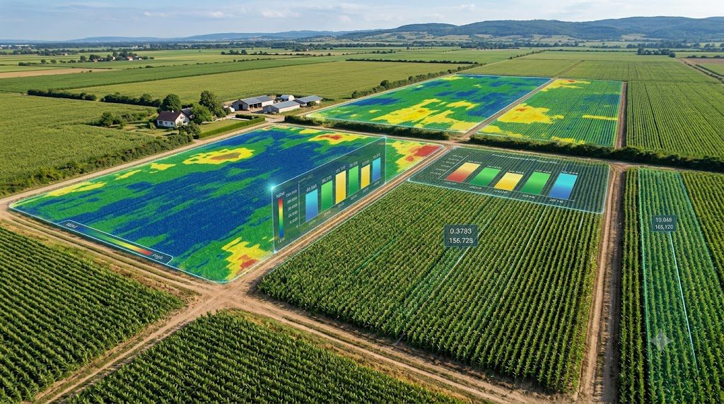
AI crop yield prediction — using satellite imagery, weather data, and machine learning to forecast how much a field will produce before harvest — went from a research topic to a front-page agricultural policy story on September 1, 2026, when USDA Secretary Brooke Rollins announced the agency would begin testing satellite imagery and AI, in direct partnership with NASA, to fix a credibility problem with its own crop estimates.
This article covers what AI yield prediction actually does, why the federal government just made it a national priority, what the peer-reviewed research shows about its accuracy, and what it means for farmers who rely on these numbers every season.
What Is AI Crop Yield Prediction?
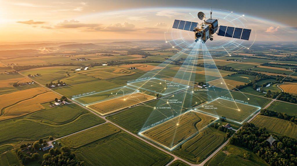
AI crop yield prediction uses machine learning models trained on satellite imagery, weather data, soil conditions, and historical yield records to forecast how much a crop will produce, often at the level of an individual field, before harvest actually happens.
Research from Michigan State University, published via NASA’s Landsat program, frames the core problem directly: traditional yield forecasts relying on historical averages and USDA-level survey data are done “at a scale that doesn’t help farmers make more precise decisions about the forecasting yields of their own fields,” according to MSU Foundation Professor Bruno Basso. AI-based approaches aim to close that gap by working at the individual-field or even subfield level, rather than a broad regional average.
Why This Just Became Urgent: USDA’s September 2026 Announcement
1. USDA is directly overhauling how it estimates crop production, in partnership with NASA. According to Farm Policy News from the University of Illinois, which reported on Reuters’ original coverage by Karl Plume and P.J. Huffstutter, Agriculture Secretary Brooke Rollins announced at the Farm Progress Show in Boone, Iowa on September 1, 2026, that USDA “will conduct a pilot to evaluate the use of improved satellite imagery, working with NASA and other federal government agencies… to figure out how we can make this reporting more accurate.”
2. This follows real, market-moving criticism of USDA’s data reliability. The same reporting notes the announcement came after a month of listening sessions with farmers and agricultural groups, amid mounting criticism from farmers and grain traders over large discrepancies between preliminary and final 2025 corn acreage estimates — discrepancies that directly move corn, wheat, and soybean futures prices.
3. The plan explicitly names artificial intelligence and machine learning as tools under evaluation. Beyond satellite imagery, USDA’s own data modernization plan states it will integrate data and technology platforms by “expanding secure data-sharing capabilities, and evaluating responsible uses of artificial intelligence and machine learning,” according to the same sourced reporting.
4. Federal research funding for this exact problem has been active for years, ahead of the policy announcement. A USDA National Institute of Food and Agriculture grant record shows a $649,786 active grant to the University of Wisconsin, running from January 2022 through January 2026, specifically to develop an integrated deep learning model framework for county-level crop yield prediction “in support of USDA NASS operation” — meaning the research groundwork for this pivot predates the public announcement by years.
5. This isn’t USDA’s first use of satellite data, but it is a significant expansion. USDA’s own historical documentation confirms the agency’s National Agricultural Statistics Service has used Landsat satellite data since the 1970s through its Cropland Data Layer program, with resolution improving from 30 meters to 10 meters in recent years — the 2026 announcement formalizes AI and machine learning as the next step on top of that decades-long foundation.
How AI Crop Yield Prediction Actually Works
Data Inputs
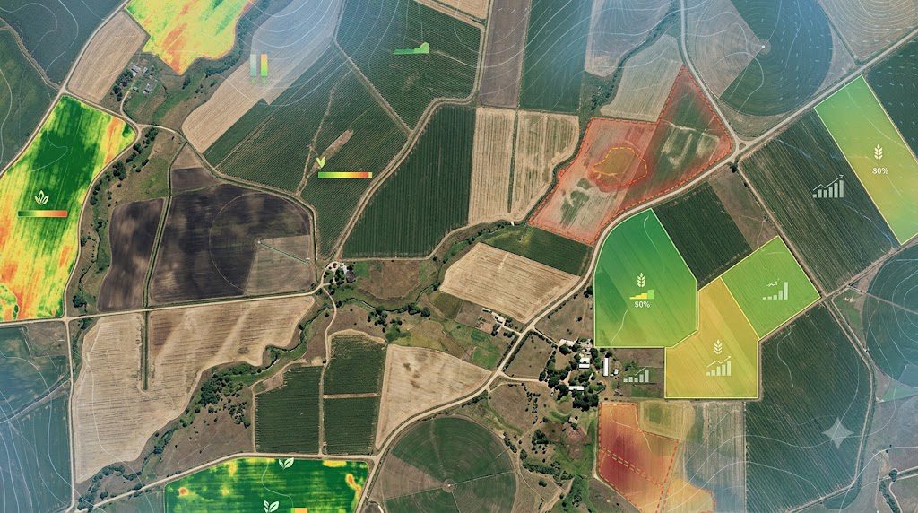
Modern systems combine multiple data streams: satellite vegetation indices (measuring plant health from space), weather data, soil conditions, and historical yield records. According to industry analysis of current AI yield prediction tools, models using any single data source underperform those combining all four by 20% to 30%.
The Machine Learning Model
Per the peer-reviewed NASA-published research from Michigan State University, one validated approach combines a crop drought index — measuring in-season water deficit — with a green chlorophyll vegetation index derived from Landsat satellite data, feeding both into a machine learning model to produce substantially improved corn yield predictions compared to historical-average methods alone.
The research, conducted across 352 fields in Michigan, Indiana, Illinois, and Iowa using more than 2,500 yield maps, was published in the peer-reviewed journal Remote Sensing of Environment.
Field-Level vs. Regional Estimates
The key technical advance is resolution. Traditional USDA estimates operate at a state or national level, useful for markets and policy but not for an individual farmer’s planting or harvest decisions.
AI-driven models increasingly work at the field or even subfield level, enabling what researchers describe as “selective harvesting, priority scheduling, and accurate resource allocation” based on zone-specific predictions rather than a single farm-wide average.
The Peer-Reviewed Research Behind the Headlines
This is worth separating clearly from the policy announcement, because the two are related but distinct.
The Michigan State University research cited above was peer-reviewed and published years before USDA’s September 2026 policy shift — the NASA feature describing it dates to 2022.
That timeline matters: it means USDA’s current pivot toward AI and satellite-based yield estimation is following an already-established academic research direction, not launching from scratch based on political pressure alone.
Basso’s team found that incorporating the crop drought index and vegetation index together produced predictions that “significantly outperformed” earlier baseline methods — a specific, measurable improvement rather than a vague claim of “better accuracy.”
That said, the researchers themselves frame this as bridging two previously separate fields — remote sensing and agronomy — rather than declaring the problem solved. Graduate researcher Guanyuan Shuai noted the approach had “never been done in remote sensing for the last 30 years” in this particular combined form, indicating the field is still in a period of active methodological development, not settled practice.
AI Prediction vs. Traditional Survey-Based Estimates
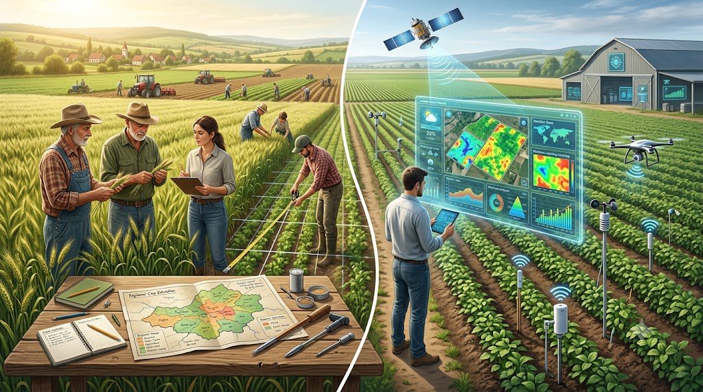
| Factor | Traditional USDA Survey Method | AI/Satellite-Based Prediction |
|---|---|---|
| Data source | Farmer-reported surveys, field visits | Satellite imagery, weather data, historical records |
| Resolution | State/regional/national level | Increasingly field or subfield level |
| Timeliness | Periodic reports on a fixed schedule | Can update continuously through the season |
| 2025-2026 reliability track record | Faced criticism over large revision discrepancies | Actively being piloted specifically to address that gap |
| Farmer actionability | Useful for market and policy context | Directly useful for individual planting/harvest decisions |
The honest takeaway: this isn’t AI replacing farmer surveys wholesale — USDA’s own plan keeps producer-reported information as part of the system while testing whether satellite and AI tools provide a stronger statistical foundation alongside it, not instead of it.
What This Means for Individual Farmers
This question matters more than the policy mechanics, and it’s worth answering directly: does a national USDA methodology change actually affect an individual farm’s operations?
Indirectly, yes, in a few concrete ways. More accurate national and county-level estimates mean the futures prices farmers sell into are less likely to be built on data that gets sharply revised after planting or marketing decisions are already made — the 2025 corn acreage discrepancies that prompted this reform directly moved prices farmers received at delivery, according to the sourced reporting.
Separately, the same underlying AI and satellite technology that powers USDA’s national estimates is increasingly available to individual farms through commercial and university tools, letting a grower get field-level predictions rather than relying solely on county or state averages.
This connects directly to the broader shift toward remote sensing and data-driven decision-making already covered in our precision agriculture guide — USDA’s pivot is, in effect, the federal government adopting at national scale a set of tools individual farms have been piloting for years.
Who’s Building This: Research and Commercial Players
USDA’s National Agricultural Statistics Service (NASS) is the federal agency at the center of this shift, and per its own historical documentation, has used satellite data since the Landsat program began in the 1970s, expanding its Cropland Data Layer to cover the entire lower 48 states by 2008.
NASA is USDA’s direct technical partner in the newly announced pilot, continuing a collaboration that goes back decades through the joint NASA-USGS Landsat program.
University research programs, including Michigan State University’s peer-reviewed work on drought-index-integrated yield models and the University of Wisconsin’s federally funded deep learning framework specifically built to support USDA NASS operations, represent the academic foundation this policy shift is building on.
Commercial satellite and analytics providers are also part of this landscape — Planet Labs previously partnered directly with USDA-NASS to integrate its Basemaps satellite data into agency operations, according to a company press release, aimed at exploring higher-resolution, more timely crop area and yield assessments.
Independent third-party forecasters occupy an interesting position in this shift worth naming directly. Private firms have built businesses selling proprietary satellite-and-AI yield forecasts to hedge funds and grain traders — a market that exists precisely because official USDA numbers have been seen as slower or less precise.
If USDA’s own pilot succeeds in delivering comparably accurate public estimates, it would compress the informational advantage those private forecasters have been selling, since public crop data was originally designed to give every market participant the same baseline information.
That’s a real competitive dynamic worth understanding, not just a technical footnote — it explains part of why this reform matters beyond individual farm decisions, reaching into how grain markets price risk.
If you’re evaluating a commercial AI yield prediction tool for your own operation, ask directly which data sources it combines and whether it’s been validated at the field level for your specific crop and region — the research above shows single-source models consistently underperform multi-source ones.
Real Limitations Worth Knowing
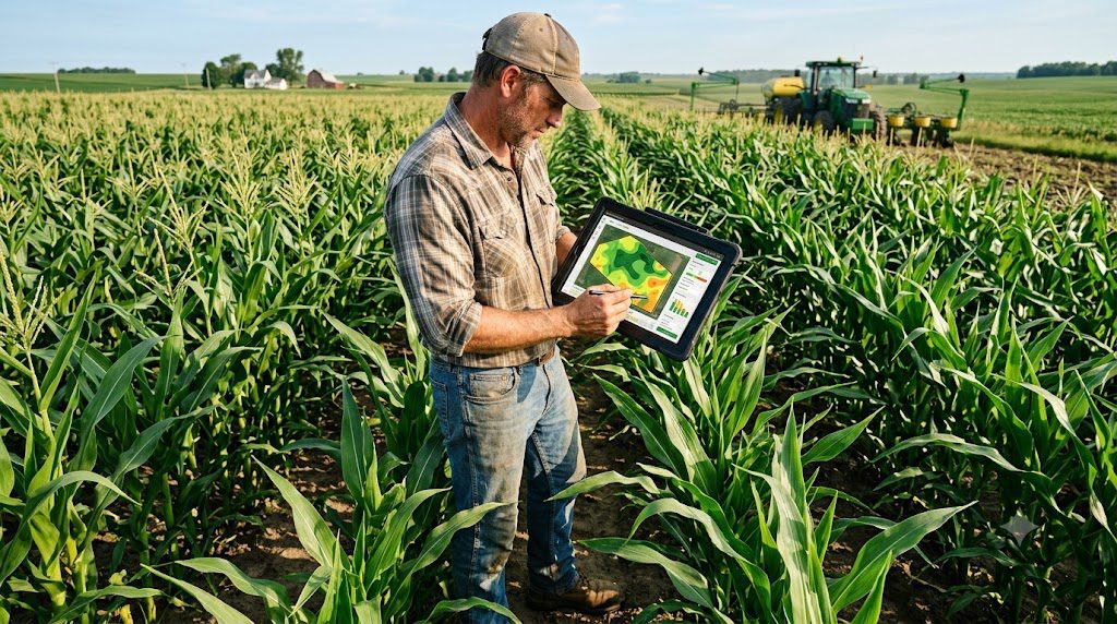
No credible source treats AI crop yield prediction as a solved problem, including USDA itself.
- This is explicitly a pilot, not a finished system. USDA’s own announcement frames this as evaluation, not full deployment — the agency plans to test AI and satellite methods alongside existing survey methods rather than replacing them immediately.
- Cloud cover and atmospheric conditions remain a known constraint. Historical USDA satellite research has long identified that nearly cloud-free data is needed for acceptable crop classification accuracy, a physical limitation that doesn’t disappear with better AI models.
- The credibility problem driving this reform is itself evidence of past limitations. The large discrepancies between preliminary and final 2025 estimates that prompted farmer criticism happened using the current methodology — a reminder that no yield estimation approach, including the current one, has been immune to significant error.
- Field-level AI models require substantial historical data to calibrate well. Commercial guidance on this technology notes that custom models trained on a farm’s own data need five or more years of yield records for highest accuracy, meaning newer operations or first-time adopters should expect a calibration period, not instant precision.
- Transparency commitments are still being tested. USDA has stated it will publish more information on methodologies, response rates, and data limitations as part of this modernization effort — a commitment worth watching for follow-through rather than assuming automatically.
How to Evaluate a Yield Prediction Tool
- Ask which data sources are combined, since research consistently shows multi-source models (satellite, weather, soil, historical yield) outperform single-source approaches by a meaningful margin.
- Understand the resolution level, since a county-level estimate and a field-level, zone-specific prediction serve very different decisions.
- Ask how many years of your own yield data the model needs to calibrate, particularly for custom models built on your specific fields.
- Treat early-season forecasts as directional, not final, since forecast value and accuracy trade off against how many weeks before harvest the prediction is made.
- Watch USDA’s own pilot results as they’re published, since the agency’s stated commitment to publishing methodology and error bounds will offer a useful public benchmark for evaluating any commercial tool’s claims.
This kind of evaluation discipline fits the same due-diligence approach worth applying to any agritech tool covered on this site — treating accuracy claims as a starting question rather than a settled fact.
Common Mistakes Farmers Make
- Treating a national or county-level USDA estimate as directly applicable to their own field, when the entire point of the field-level AI shift is that regional averages don’t capture individual field variation.
- Choosing a yield prediction tool based on a single data source, when the research is clear that combined data sources meaningfully outperform single-source models.
- Expecting instant accuracy from a custom model with limited historical data, rather than understanding the multi-year calibration period genuinely required.
- Not distinguishing between an early-season forecast and a near-harvest estimate, when the research shows these carry meaningfully different accuracy and decision value.
For farms already tracking yield data through modern equipment, this connects to the GPS and yield-mapping capabilities already covered in our combine harvester and equipment guide, which increasingly feed directly into the same kind of field-level prediction models discussed here.
FAQs About AI Crop Yield Prediction
1. What is AI crop yield prediction?
AI crop yield prediction uses machine learning, satellite imagery, weather data, soil conditions, and historical yield records to estimate how much a crop may produce before harvest. These systems can increasingly provide predictions at the field or subfield level.
2. Why is USDA using AI for crop yield estimates in 2026?
USDA announced a pilot to evaluate satellite imagery, artificial intelligence, and machine learning for improving crop production estimates. The initiative is being developed in partnership with NASA and other federal agencies.
3. How does AI crop yield prediction work?
AI yield prediction models combine information such as satellite vegetation indices, weather conditions, soil data, and historical yield records. Machine learning models then analyze these inputs to estimate expected crop yields.
4. Can AI predict crop yields at the individual field level?
Yes. Unlike traditional estimates that often operate at state, regional, or national levels, some AI-based systems can generate predictions at the individual-field or subfield level. This can support more targeted resource allocation and harvest planning.
5. Is AI crop yield prediction more accurate than traditional methods?
The article cites peer-reviewed Michigan State University research showing that combining satellite-derived drought and vegetation indices with machine learning significantly improved predictions compared with historical-average methods. However, USDA’s current AI initiative remains a pilot rather than a completed replacement for traditional methods.
6. Will USDA stop surveying farmers because of AI crop prediction?
No. The article states that USDA plans to keep producer-reported information as part of the system while evaluating satellite and AI technologies as additional sources of statistical information.
7. Can farmers use AI crop yield prediction tools?
Yes. Commercial platforms and university research programs are increasingly making satellite, weather, and machine-learning technologies available for individual farm applications. Farmers should evaluate whether a tool has been validated for their particular crop, region, and field conditions.
8. How much historical data is needed for AI crop yield prediction?
The article notes that commercial guidance suggests custom models can benefit from five or more years of farm-specific yield records for calibration. Farms with less historical data should therefore expect a calibration period rather than immediate highly precise predictions.
9. What are the limitations of AI crop yield prediction?
Important limitations include cloud cover and atmospheric conditions affecting satellite imagery, the need for sufficient historical data, differences in prediction accuracy depending on forecast timing, and the fact that USDA’s current system is still being evaluated through a pilot.
10. Can AI crop yield predictions affect grain prices?
Potentially. More timely and accurate crop estimates could reduce large revisions between preliminary and final estimates, which can influence agricultural markets. The article also notes that improved public forecasting could affect the competitive advantage of private satellite-and-AI forecasting providers.
Final Thought
AI crop yield prediction moved from an academic research topic to a live federal policy priority in a single announcement on September 1, 2026 — and the underlying science, including peer-reviewed Michigan State University research published through NASA, genuinely supports the direction USDA is now taking.
But this is explicitly a pilot responding to a real credibility problem, not a finished system, and USDA itself is keeping traditional farmer surveys in place while it evaluates the new approach.
For individual farmers, the practical takeaway isn’t to expect immediate, perfectly accurate national forecasts — it’s to recognize that the same field-level, multi-source prediction technology increasingly available commercially is now also becoming the federal government’s own standard, which is as strong a signal as this technology has ever received that it works.
Related reading on this site: Precision Farming Ultimate: Precision Ag & Vertical Farming, Agric Technology: Transforming Agriculture for Greater Productivity in 2026, and Combine Harvester: 7 Powerful Breakthroughs with Electric Tractors.